Starting from €7,500
Our AI-Driven Mineral Exploration Targeting service provides an integrated, next-generation approach to early-stage mineral exploration, combining advanced data analytics with professional geological interpretation.
We integrate artificial intelligence, satellite remote sensing (including Sentinel-2 VNIR/SWIR), and multi-source geoscientific datasets to identify, rank and prioritise exploration targets across licence-scale and regional project areas.
Integrated Data Fusion Approach
Our proprietary workflows integrate multiple exploration datasets within a unified predictive framework, including:
Spectral mineralogical and alteration analysis using VNIR/SWIR remote-sensing data
Geochemical signatures and multi-element associations
Structural and tectonic interpretation, including faults, shear zones and lithological boundaries
Gas-anomaly proxy analysis, including CH₄, He, CO₂ and H₂ where appropriate datasets are available
Lithological and stratigraphic modelling
Historical exploration data and known mineral occurrences
Available geophysical, drilling and geological datasets where applicable
These datasets are analysed using advanced machine-learning and statistical modelling, including Random Forest, ensemble and stacking approaches, and Bayesian frameworks.
The objective is to identify complex spatial relationships between geological, structural, geochemical, spectral and geophysical variables that may not be apparent from individual datasets considered separately.
Advanced Targeting & Predictive Modelling
Depending on data availability and project scale, the workflow may deliver:
Probability-based mineral prospectivity maps
Identification of prospective mineralisation corridors, target cores and structural controls
Interpretation of potential oxide, sulphide-related and supergene environments
Differentiation of near-surface and potentially deeper target domains
Ranking and prioritisation of exploration targets according to geological confidence and supporting evidence
The workflow supports a structured progression from regional screening through target definition and field validation to drill-target generation.
3D Geological Intelligence
Where sufficient geological, geophysical, geochemical or drilling data are available, the targeting workflow can be extended into 3D predictive geological modelling, including:
Depth-constrained integration of geological, geochemical and geophysical indicators
Structurally constrained mineralisation modelling
AI-assisted interpretation of target geometry and depth distribution
Development of 3D exploration target envelopes
Generation and optimisation of preliminary drill-target positions
Strategic Value
The service is designed to provide practical exploration advantages, including:
Reduction of geological uncertainty through integrated data analysis
Improved allocation of exploration capital toward higher-priority areas
Faster progression from regional screening to field investigation and drilling
Application to frontier, underexplored and data-limited regions
Improved exploration decision-making through quantified prospectivity and target-ranking models
Deliverables
Depending on the agreed scope, deliverables may include:
AI-generated mineral prospectivity maps
Ranked inventory of priority exploration targets
Structural, lithological and geological interpretation layers
Spectral alteration and mineralogical proxy maps
Optional 3D geological and mineralisation-target models
GIS-ready outputs, including GeoTIFF, KML/KMZ and vector datasets
Micromine-compatible datasets
Target coordinates and ranking tables
Comprehensive technical report
Pricing Structure
Pricing depends on project scale, data availability, geological complexity and the required level of modelling.
Base Targeting Package
€7,500–€8,500
Suitable for licence-scale or focused exploration areas.
Typically includes:
Satellite and geological data integration
AI-assisted mineral prospectivity analysis
Target generation and ranking
GIS-ready outputs
Technical report
Regional-Scale Advanced Targeting & Modelling
€45,000–€80,000
Designed for large regional studies, multi-licence programmes and geologically complex project areas.
Final pricing depends on:
Total area covered
Number of satellite scenes processed
Geological and structural complexity
Availability and volume of geophysical, geochemical and drilling data
Required modelling depth
Number and type of commodities investigated
Requirement for 3D modelling and drill-target generation
Regional programmes may include:
Multi-scene satellite processing
Advanced AI-based prospectivity modelling
Regional structural and geological interpretation
Integration of geophysical and geochemical datasets
Generation and ranking of multiple exploration target zones
2D and optional 3D predictive modelling
Detailed technical reporting suitable for technical, investment and strategic decision-making
Commercial Note
This is a specialised geological and data-driven exploration consulting service combining advanced analytical technologies with professional geological interpretation.
Each project is customised according to exploration objectives, available datasets, project scale and the required level of technical detail.
Final pricing and deliverables are confirmed following scope definition and review of available project data.

 Image 1 of 13
 Image 2 of 13
 Image 3 of 13
 Image 4 of 13
 Image 5 of 13
 Image 6 of 13
 Image 7 of 13
 Image 8 of 13
 Image 9 of 13
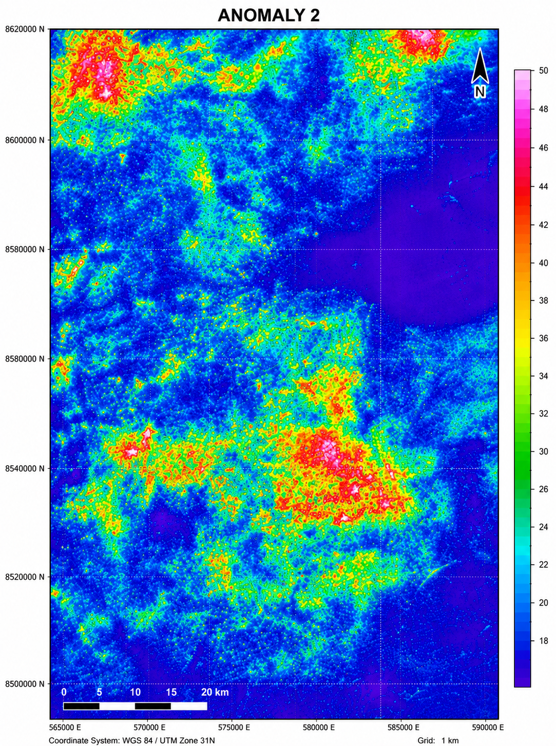 Image 10 of 13
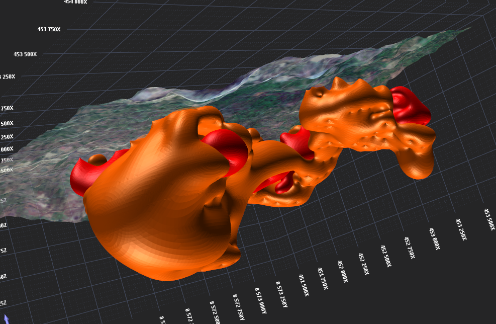 Image 11 of 13
 Image 12 of 13
 Image 13 of 13